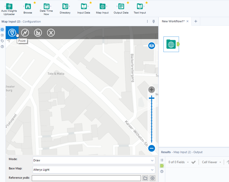
In Alteryx we can manually draw or select map objects with Point, Line or Polygon. First we need to drag Map Input tool to the canvas. Then we see a Map on the configuration pane where we can zoom, pan and move around to see other continents and countries or the location you want to see.
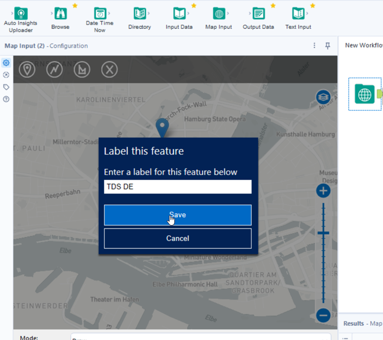
In my example, I want to search for The Data School office in Hamburg, Germany.
At the top of the configuration panel we see the point, line and polygon options.
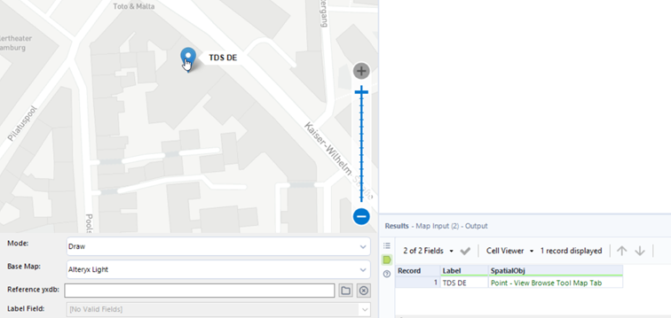
By selecting the point option and clicking on the point on the map, it will create a spatial object, which will be saved in the column called Spatial Obj. In a column called Label, we will store the name of the point we give.
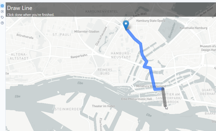
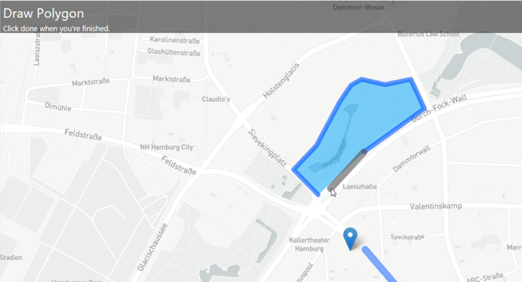
In the similar way we can create line and polygon by choosing the options of the configuration panel:
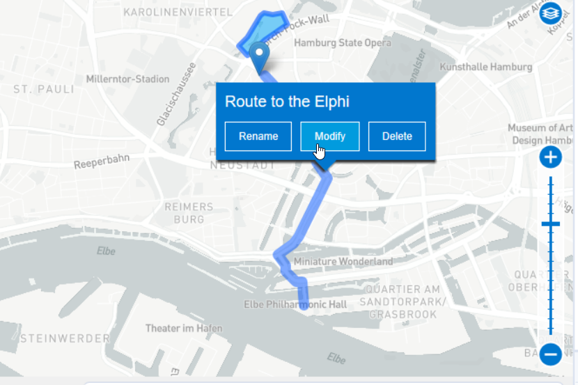
If we want to delete, modify or rename one of the objects drawn, we should select on the object on the map and choose an option:
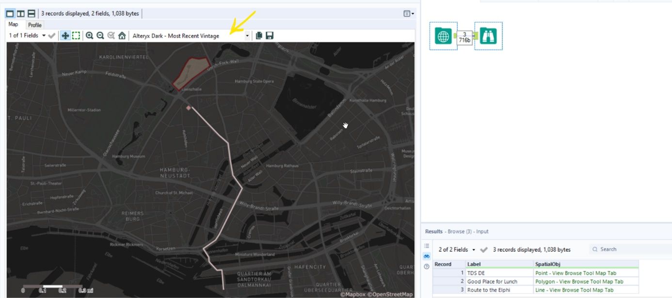
We can use the browser tool to check out what we've done and change a base map we want: