


Let's say we want to build Airline Routes for the airports in the US.
After connecting the Air routes data to Tableau, first, I would like to see where those origin and destination airports are in the map. So I need to create two calculated fields, Origin and Destination. Then, double click Origin, the map shows where these origin airports are.
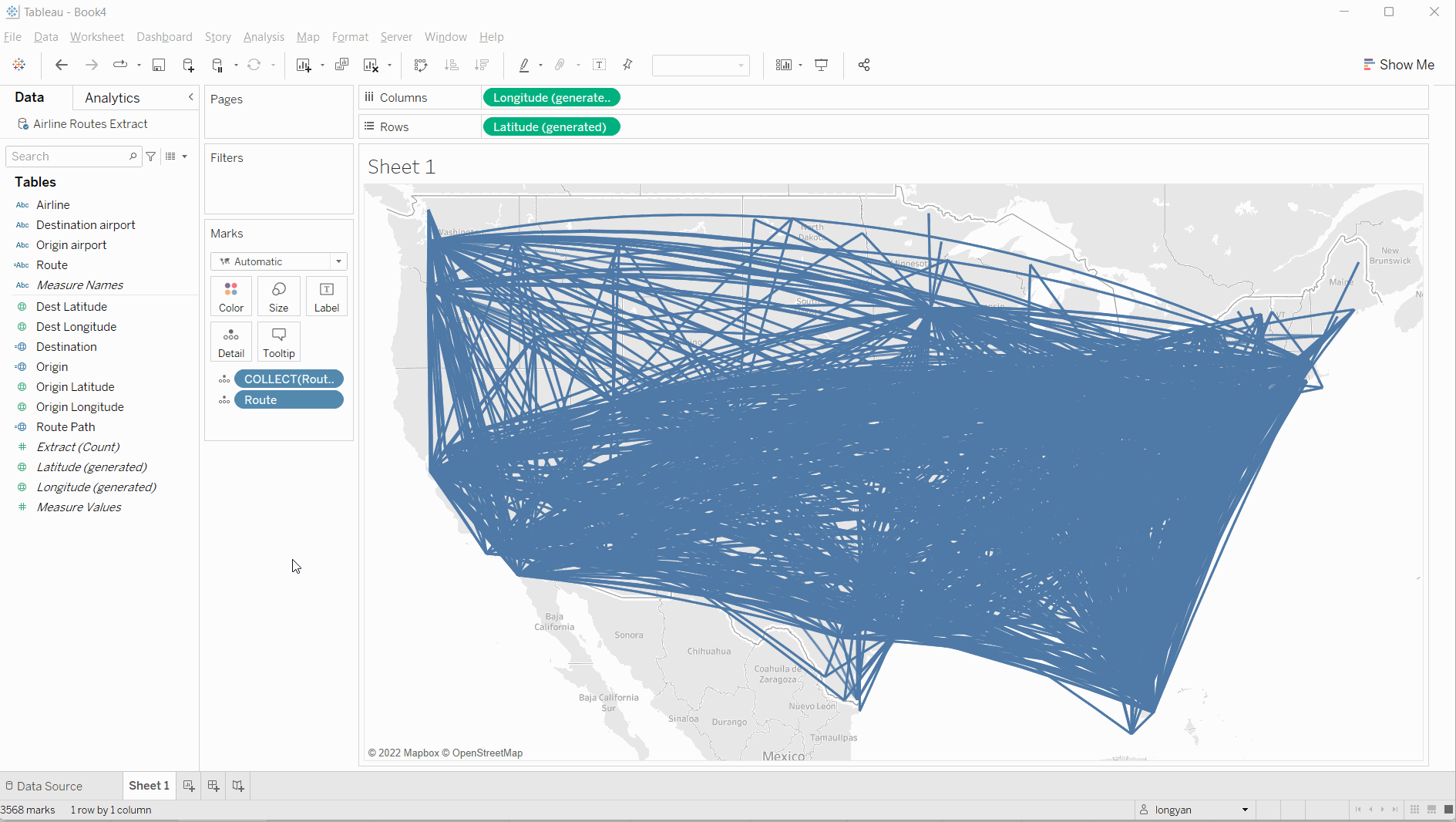
Then, I want to see how the flights flying path between origin and destination airports. In order to see it, we need to create a calculated field to show the flying paths. Let's call it Route Path and then double click it after it's done. The map shows a big blue multiline paths and it comes out only one mark.
This is because we do not have specific paths with origin and destination airports for it. In another word, there is no dimension in Detail to split it up. So we need to create another new calculated field for it. We call it Route.

After the Route is done, I dragged it into Detail shelf. When I hover the map, you will see lots of flying path with origin and destination airports' name for it. As you may notice the marks has been changed to 3568.
Lastly, I want to see the distance in those flying paths. I need to create a calculated field called distance. After this, bring the distance to the Color shelf. When I hover it, it shows the distance and origin and destination airport in Tooltip.
Now, we get what we expected. Hopefully, this blog is helpful for those who want to build a similar map.