


Today's aim was to produce a spatial analysis using solely alteryx.
My aim was to show which airports have only preferred routes under a certain distance, showing these airports could be removed and replaced by train stations for a more environmentally friendly world.
My report therefore shows all airports which have no flights of more than 400 miles (2hrs of train) and what is the closest airport to them, in order to keep allowing transport to those regions.
The steps for this were to first retrieve all of the airports in the US and their coordinates. Then to calculate the distance between each existing flights and categorising airports based on the longest flight travelling more than 400 miles. Make sure to include both origins and destination airports in the data in order to have a report as complete as possible. Here is the end report:
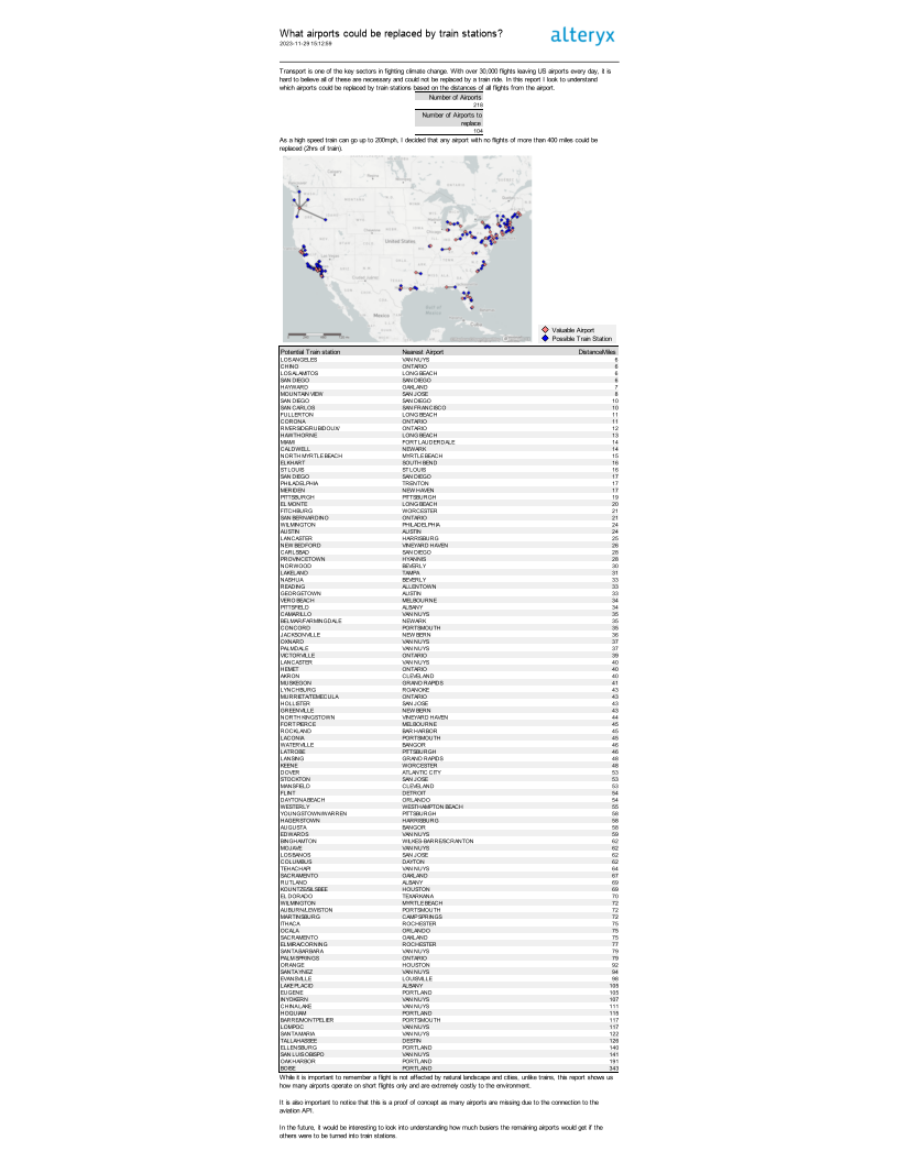
It is not the prettiest but it will do.
Here are some bloopers:
It was tough to work on Alteryx all day, the delays in API, longitude and latitude problems and slow running time really did not help. :)