


When recapping some Alteryx we took a deep dive into the spatial tools. This blog discusses the tools, presents a use case for them and points out some handy pointers with a few.
Buffer:
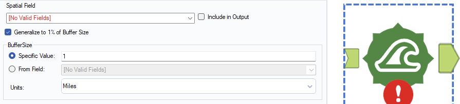
Buffer creates a polygon surrounding an existing spatial object (point, line or polygon). For example, a buffer around a line creates a sausage shaped polygon.
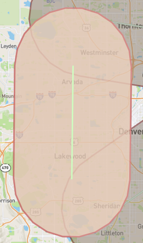
The size of the buffer polygon is specified in the buffer size section. This can be useful if you perhaps wanted to find locations in a dataset within x distance from a spatial object you create like a trainline.
Create Points:
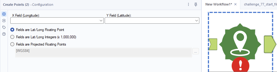
Create points takes Longitude and Latitude values from a field and creates a point as a spatial object. The trick with this tool is that the longitude and latitude need to be in a numeric format and the information needs to be on the same row for the point. The final point is that if you have a point with a different measure like Eastings and Northings you can use the third check box to explore the options Alteryx has pre-built in to handle such cases and process them.
Distance:
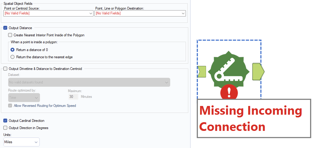
Distancce tool is another that wants the information on the same row. You give it two spatial objects a start (either a point or a centre-point of a line or polygon) and an end and it will calculate the distance between them in either miles or kilometres. It can give you a direction as well (either a compass direction or a degree value).
Find Nearest:
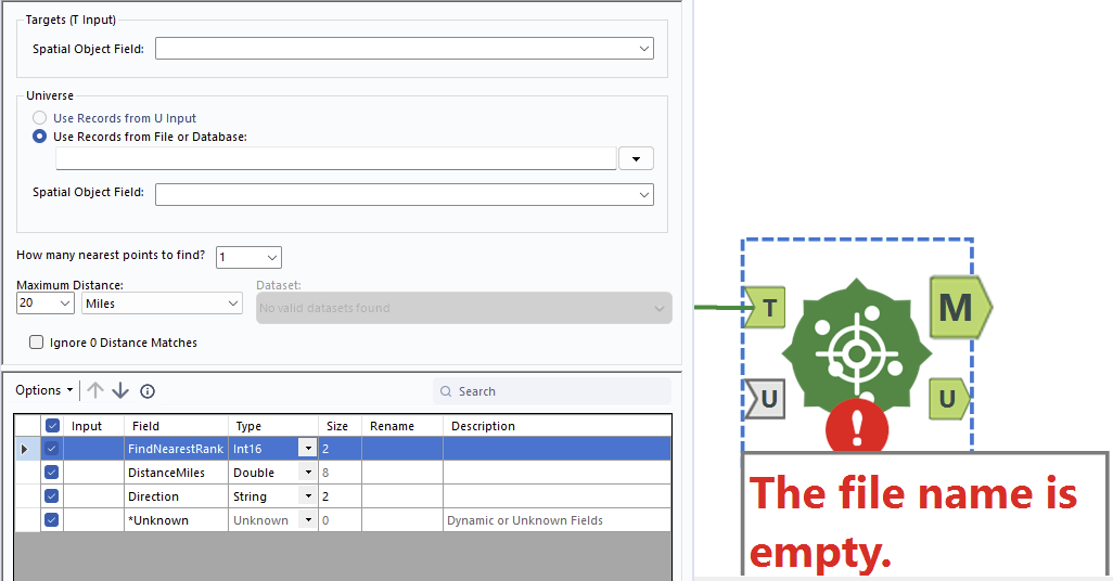
Find nearest takes a target spatial object and compares it to a column of spatial objects. You can tell it to return the nearest or the n nearest objects in the universe relative to the target object. A use-case for Find Nearest might be an iterative macro that plots the best route for minimizing distance between each given stop.
Generalize:
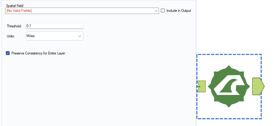
I am yet to use generalize but we can tell a lot from an Alteryx tool from its tool icon. Here we can use the tool to create a more general polygon to contain an original polygon. When we say more general we mean simpler in construction, less nodes. I think it might make sense to use generalize if you are less concerned with spatial precision and more concerned with performance as making the objects less detailed strikes me as a way to increase performance.
Polybuild Tool:
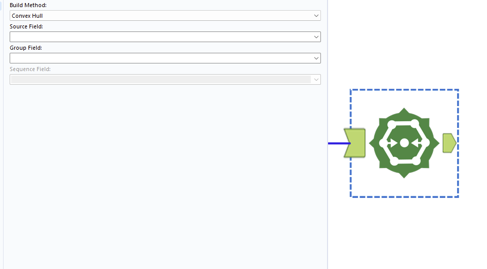
The polybuild tool allows users to construct objects from a series of points. The most common are making a poly-line with a series of points (we now want them on seperate rows with a field indicating the sequence in which they should be combined. Otherwise, you might want to make a polygon. The group field indicates whether to group certain rows into seperate polygons/lines.
Polysplit Tool:
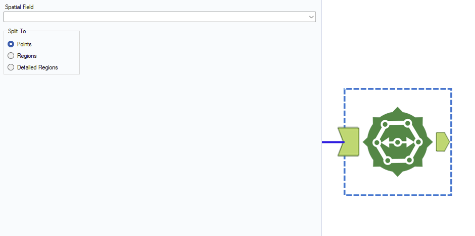
Poly-split is the inverse of polybuild and will return the component points of a polygon/line.
Smooth Tool:
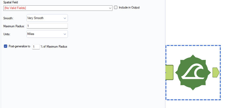
I have only used the smooth tool once and it was to get points at a more granular level around a curve that I created. Unticking the post-generalize box was important for keeping the detail of this smoothing process. I also believe that increasing the maximum radius was important for increasing the detail of the points rather than the other way round.
I intend to finish off the pallette in a follow-up blog.