Distance
The Alteryx 'Distance' tool is used to quite literally find the distance between to two spatial points.
The tool works by first inputting two separate fields of given spatial points into the input anchor before configuring the tool
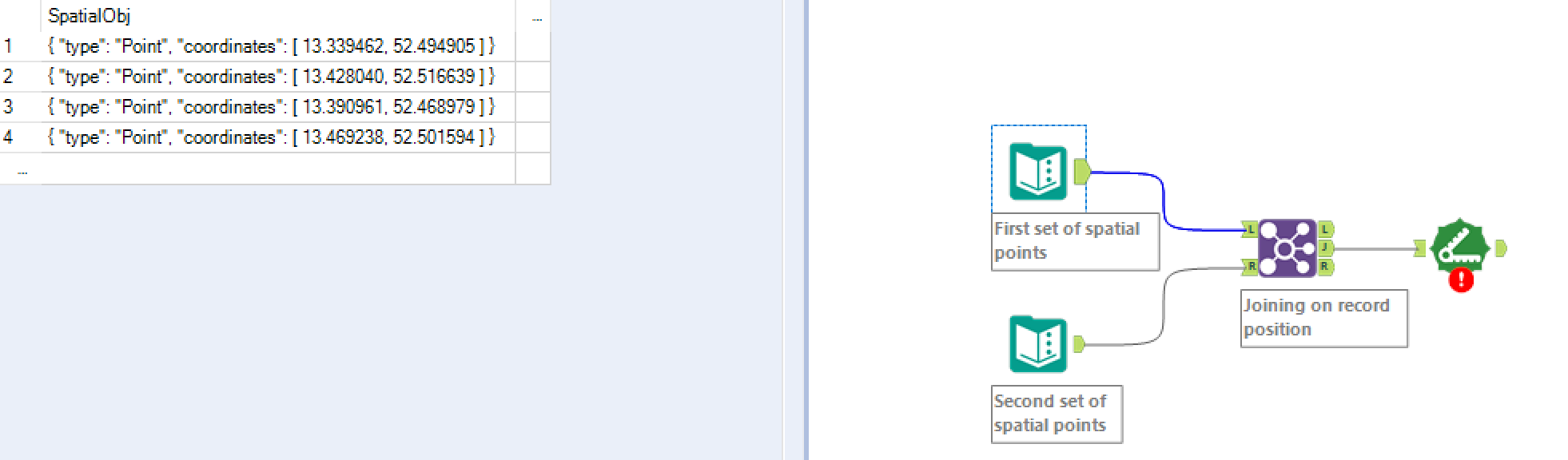
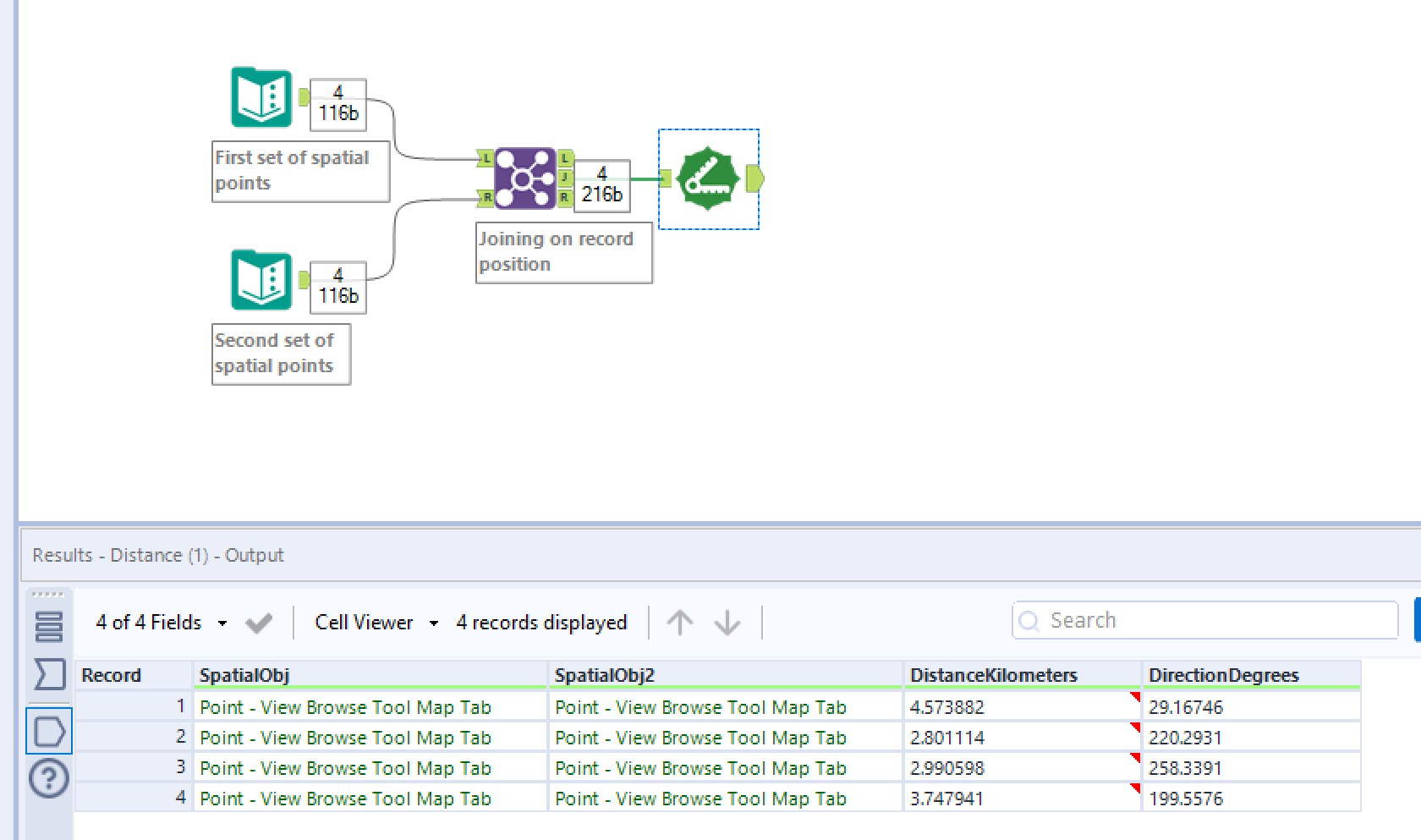
In our example we will be using 2 sets of four spatial points. I have joined these on record position to create two independent columns to be compared against each other in the Distance tool.
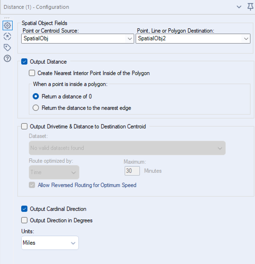
Next we need to configure the Distance tool as shown above. Firstly, selecting our original point under 'Point or Centroid Source:' and our target point 'Point, Line or Polygon Destination:'.
We will be selecting 'Output Distance' to return a direct distance between our original and target points. Selecting ' Output Drivetime & Distance to Destination Centroid' will take into account the real geographical layout of the area to calculate the distance/time if actually travelled e.g. you can't through a lake.
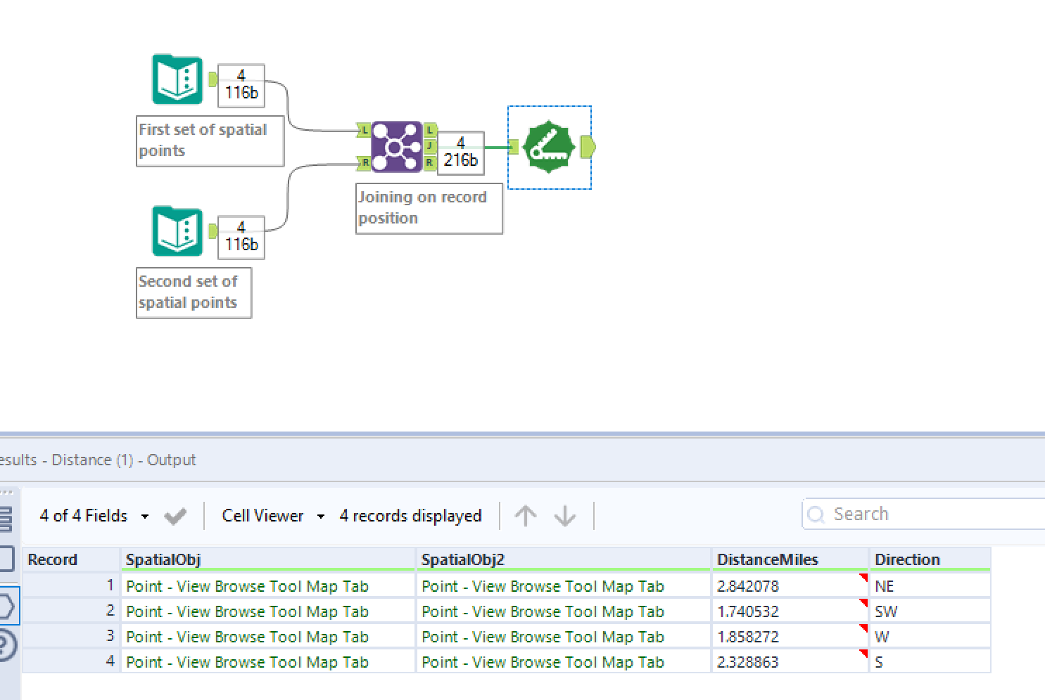
Once we hit run we can see two new fields have been created 'DistanceMiles' and 'Direction'. The first being our distance in Miles and second the Cardinal Direction. Both of these can be edited at the bottom of the configuration pane:
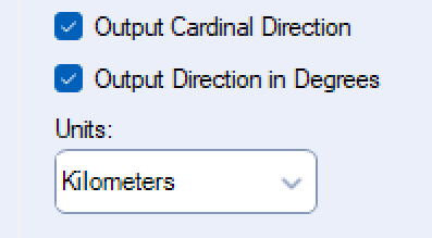
If we were to change our unites to Kilometres and our output direction to degrees we would receive the following output instead: