A quick blog going over the key spatial tool, 'Create Points'. This tool allows the user to convert a pair of longitude & latitude coordinates into a spatial point within Alteryx. This point can then be used for the other spatial tools in your Alteryx workflows.
A wise Data School coach named Ruth once told me 'aLONGitude' the hallway and 'upTITUDE' the stairs? Or something along (alat) those lines. Either way, Longitude refers to your X coordinates and Latitude for Y coordinates
In our example we will be inputting a list of Long/Lat coordinates into our Create Points tool and using a browse tool to observe the results.
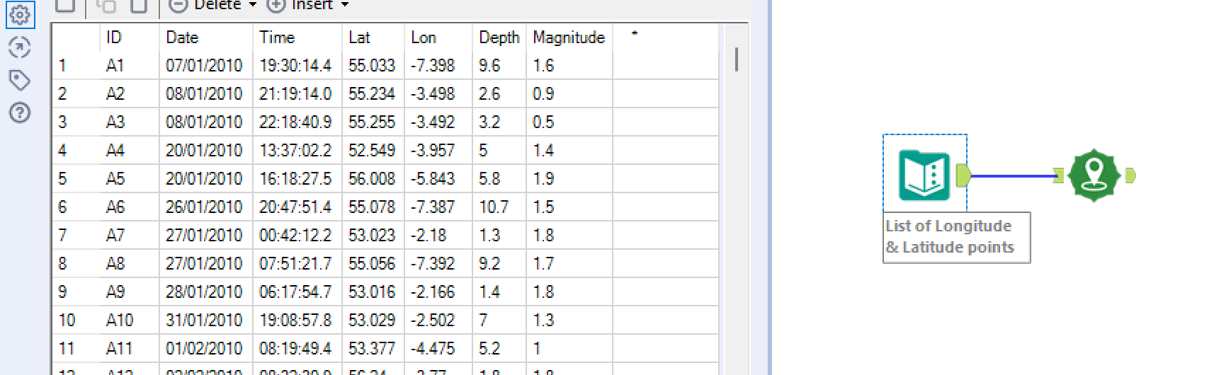
Once our data is connected to our Create Points tool we can than configure our tool to allocate the correct fields to generate our spatial points.
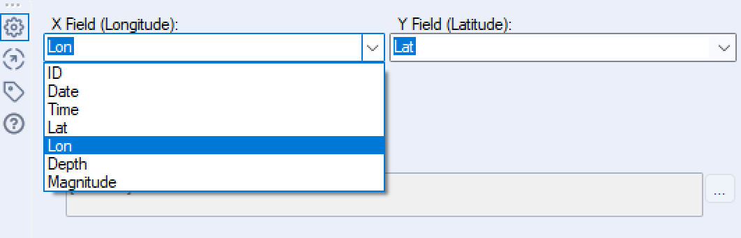
Assign the the correct fields for the corresponding Longitude and Latitude.
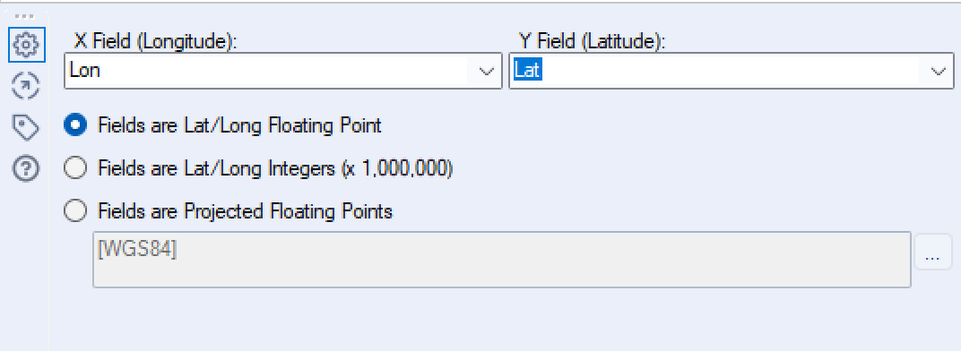
In our case we will select 'Fields are Lat/Long Floating Point' as this is the format our of data. This is the most common form of Lat/Long data to appear in. 'Fields are Lat/Long Integers (x 1,000,000) is another common format. The final option 'Fields are Projected Floating Points' refers to custom methods of allocating geographical points, generally niche to certain countries e.g. a countries national grid.
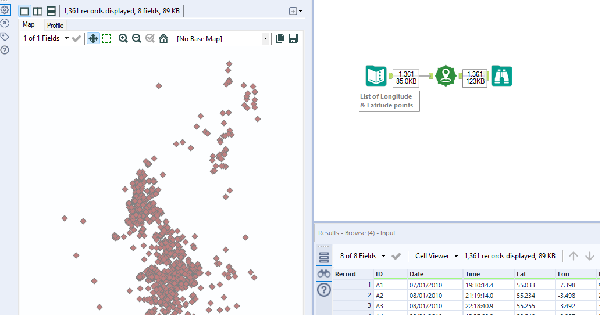
Once, we've configured our Create Points tool we can simply add a browse tool to it's output anchor and hit run to view our Long/Lat coordinates as spatial points:
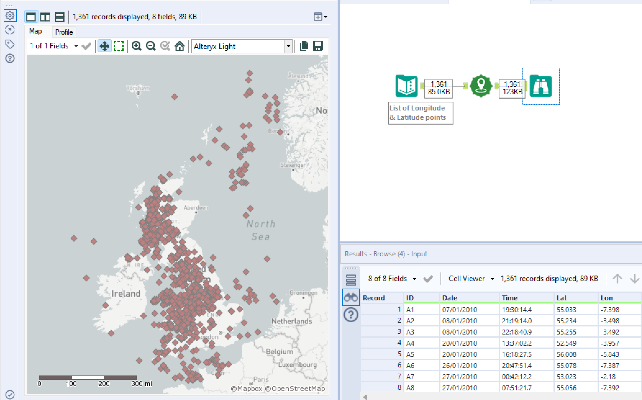
If you add a 'Base Map' you can then view the spatial points within the context of a map as shown:
The ability to create spatial points with the 'Create Points' tool creates a basis to use and understand all the other spatial tools! I will be exploring a few of these in future blogs.